Due to heightened concerns following the 1969 oil spill in the Santa Barbara Channel, in 1980, a portion of the Channel off the coast of Santa Barbara and Ventura counties, was given a special protected status with the designation of the Channel Islands National Marine Sanctuary. Its remote, isolated position at the confluence of two major ocean currents supports remarkable biodiversity and productivity, and make the approximately 1110 square nautical miles of ocean waters surrounding Anacapa, Santa Cruz, Santa Rosa, San Miguel, and Santa Barbara Islands an area of national significance.
The Channel Islands National Marine Sanctuary is rich in maritime heritage, from living Chumash culture to historic shipwreck resources. Sanctuary waters are a significant maritime trade route connecting people and communities with one another and other parts of the world. Under the administration of the National Oceanic and Atmospheric Administration (NOAA), the primary goal of the sanctuary program is the protection of natural and cultural resources contained within its boundaries.

Describe your image


Describe your image

Describe your image
ANACAPA ISLAND
Anacapa Island (from the Chumash word Anyapax, meaning "mirage, illusion") is a volcanic island located about 9.6 nautical miles off the Channel Islands Harbor in Ventura County (California). With its 1.1 square miles spread over a 5 mile length, Anacapa is the second smallest of the Channel Islands. The island is composed of a series of narrow islets, East, Middle and West Anacapa, oriented East to west laying 4 nm East of Santa Cruz Island. Sometimes referred as The Anacapas, the spectacle start while approching the island from its iconic 40 foot high natural Bridge (Arch Rock) off the east end of the island. All three islets have precipitous cliffs, dropping off steeply into the sea, the highest at 930 feet elevation with the Summit Peak of West Anacapa.
The only access to the Island is "Landing Cove" and its 157 steps. This small inlet in the north side of East Anacapa is bounded by vertical cliffs where an elevated dock was built into the natural formation. Learn more about Anacapa island (@ the Unremarkable Climber).
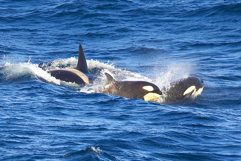
CINMS: Whale Heritage of the World
The Channel Islands National Marine Sanctuary is a vibrant destination where world-class outdoor recreation is available year long, endangered species find refuge, archaeological remains are well preserved and innovative research and conservation managment take place, all within its borders. Considering that, the Whale Heritage Area Program, initiative created by the World Cetacean Alliance and the World Animal Protection to accredit destinations around the world for outstanding and responsible managment of sustainable ecotourism, formally recognized the Santa Barbara Channel as the 9th Whale Heritage Area of the World.


The curious case of the Anacapa Island's map by James McNeill Whistler
James McNeill Whistler, an American artist most famous for his masterpiece “Arrangement in Grey and Black, No. 1.” - or, Whistler's Mother - had a brief, rocky stint as a chartmaker for the Coast and Geodetic Survey from November 1853 - February 1854. He's been described as "a draftsman who was habitually late, frequently absent, given to graffiti, and inclined to doodle on its official charts." Though his tenure lasted only three months, some credit his work creating charts with the Survey as an influence on his later career as a prolific etcher.
Whistler's doodles have survived the years, and NOAA still has one. Early Coast Survey charts included sketches of headlands, and Whistler's work appears etched on copper plates depicting the eastern side of Anacapa Island in California. Above the coastline, Whistler added a formation of birds - an unnecessary and now invaluable flair.
“Surely the birds don’t detract from the sketch.
Anacapa Island couldn’t look as blank as that map did before I added the birds.”
James McNeill Whistler
